Storytelling with a Map: Celebrating the 50th Anniversary of the Laurel Highlands Hiking Trail
CAMP HILL, PA, UNITED STATES, October 5, 2026 /EINPresswire.com/ -- As the Laurel Highlands Hiking Trail (LHHT)
Press Release Disclaimer: This is a press release distributed through the XPR Media network. It has not been independently verified by our newsroom.
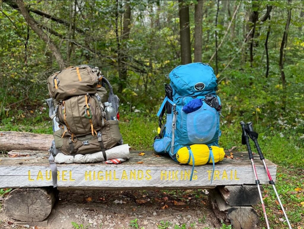

CAMP HILL, PA, UNITED STATES, October 5, 2026 /EINPresswire.com/ — As the Laurel Highlands Hiking Trail (LHHT) celebrates its 50th anniversary, Pennsylvania Parks and Forests Foundation (PPFF) intern and Shippensburg University graduate student, Eleanor Meckley, is helping tell the story of this beloved Pennsylvania trail in a new and interactive way.
Meckley created a story map highlighting the history, landscapes, and significant milestones of the 70-mile Laurel Highlands Hiking Trail. Story maps combine narrative elements, maps, photographs, graphics, and other visual elements to help audiences explore a place and its history in an engaging way.
“I’ve written trail histories before, and usually the hard part is finding the information. This was not the case for the Laurel Highlands Hiking Trail,” says Meckley. “There was so much information and stories, that the hard part was figuring out how to represent it all in a cohesive manner. As soon as I realized that the overwhelming amount of information was a direct result of how well loved the trail is, I had my framing device for the article and the story map– a love story. Cheesy? Yes. True? Absolutely.”
The LHHT stretches 70 miles along Laurel Ridge, connecting Ohiopyle State Park with the Conemaugh Gorge near Johnstown. The trail passes through Fayette, Somerset, Westmoreland, and Cambria counties and travels across a variety of public lands, including Ohiopyle State Park, Laurel Ridge State Park, Forbes State Forest, and State Game Lands 111 and 042. The LHHT is also a major segment of the Potomac Heritage National Scenic Trail.
The trail’s history dates to the early 1970s. The first portion of Laurel Ridge State Park and the Laurel Highlands Hiking Trail was officially dedicated and opened on May 15, 1974, following the acquisition of more than 11,000 acres along Laurel Ridge by the Western Pennsylvania Conservancy (WPC). In 1976, the entire 70-mile stretch of the trail was finished, complete with eight shelter areas spaced every 6-12 miles apart.
For 50 years, the LHHT has offered hikers opportunities to experience the forests, ridges, overlooks, and natural beauty of the Laurel Highlands. Meckley’s story map provides another way to explore that history and discover the people, places, and events that have helped shape and celebrate the trail over the past five decades.
“Eleanor’s story map brings the Laurel Highlands Hiking Trail to life in a way that honors its past and inspires future exploration,” said PPFF President Marci Mowery. “By weaving together history, landscapes, and personal stories, she has created a resource that deepens our connection to one of Pennsylvania’s most treasured long distance trails. Her creativity, perseverance, and passion for public lands shine through, and we are proud to support emerging conservation leaders like her.”
The Laurel Highlands Hiking Trail story map can be viewed at https://paconservationheritage.org/story-map/.
Carla Eissing
PA Parks and Forests Foundation
+1 717-236-7644
email us here
Visit us on social media:
Instagram
Facebook
YouTube
Other
Legal Disclaimer:
EIN Presswire provides this news content “as is” without warranty of any kind. We do not accept any responsibility or liability
for the accuracy, content, images, videos, licenses, completeness, legality, or reliability of the information contained in this
article. If you have any complaints or copyright issues related to this article, kindly contact the author above.

Media gallery